
Maps - Drawing a Place (Art + Books series)
Are maps going the way of the rotary phone?

Most of the time our maps are a grid of roads on a screen. Maps are still an essential tool, however. Plus, mapmaking can be a fun project for kids, especially when it’s paired with some fantastic picture books!
This is an easy project to tackle – you just need some paper and some pencils, crayons, or markers for drawing. You might also want to read these three books:
Camilla, Cartographer, by Julie Dillemuth, illustrated by Laura Wood.

The idea for this project started after we read Camilla, Cartographer. In this book, Camilla the boar dreams of becoming a mapmaker. She doesn’t think that’s possible, though – someone else had already mapped all the places she’s ever been. Then a heavy snowfall changes her world, and she discovers that there are many, many more maps to be made!

This is an easy project to tackle – you just need some paper and some pencils, crayons, or markers for drawing. You might also want to read these three books:
Camilla, Cartographer, by Julie Dillemuth, illustrated by Laura Wood.
Mapping My Day, by Julie Dillemuth, illustrated by Laura Wood.
Solving the Puzzle Under the Sea: Marie Tharp Maps the Ocean Floor, by Robert Burleigh, illustrated by Raúl Colón.
Solving the Puzzle Under the Sea: Marie Tharp Maps the Ocean Floor, by Robert Burleigh, illustrated by Raúl Colón.

The idea for this project started after we read Camilla, Cartographer. In this book, Camilla the boar dreams of becoming a mapmaker. She doesn’t think that’s possible, though – someone else had already mapped all the places she’s ever been. Then a heavy snowfall changes her world, and she discovers that there are many, many more maps to be made!
Mapping My Day explores mapmaking in even more detail, while Solving the Puzzle Under the Sea shows how scientist Marie Tharp discovered a new way to explore the ocean floor – and the movement of continental plates.
These are all three fun stories and worth reading "just because," but they are also great books to pair with a mapmaking project!
A map isn’t a picture of a place. It’s not a drawing of shapes or buildings. It’s an outline showing whether objects are inside of that area. Take a couple minutes to think about the area as if you were looking straight down at it, without any walls or ceilings to block your view. What can you see? Where are the important objects in that space?
Now think about the outside edges of that space. What do they look like? Are they four long, straight lines? Do the edges wiggle and curve? Draw these boundary lines on the paper.
What does the inside space look like? Most bedrooms will have a bed and a dresser. Houses have several rooms – all of them different sizes. A yard might have trees, a flowerbed, a driveway, or even a fence. Start drawing these details inside the boundary lines.

For this kind of map, start by measuring that total length and width of the space. Then count the number of squares on the grid and calculator the ratio of feet to squares. For example, if the space is forty feet across and the grid is twenty squares across, that’s a two to one ration. That means that each square on the grid needs to represent two feet of space. Doing this allows the mapmakers to set the correct scale for their map before they begin filling it in.

Surveyors usually use special equipment to measure elevation, but you can also use a pole with a string tied to the top. You will need to know how tall the pole is, and you can also tie knots in the string every foot to help measure distance.
Once the pole is ready, place it at the lowest point in the area you are measuring, and then stretch the string out level. If the pole is five feet tall and the level string touch a section of hillside, then that section of the hillside is five feet taller than the starting point.
Measure the distance and the elevation of several points, marking them down on the map. Then move the pole to one of these points and start the process again. Continue doing this until you have measured the elevation for the entire space.

These are all three fun stories and worth reading "just because," but they are also great books to pair with a mapmaking project!
Drawing a Map:
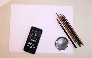
For this project, start by picking a specific place – a house, a yard, even just a bedroom.If you want, you can use a compass (or an app on a phone) to find where north is, then draw a compass rose in the corner of your paper to show north. This will help you keep your map oriented in the right direction.

A map isn’t a picture of a place. It’s not a drawing of shapes or buildings. It’s an outline showing whether objects are inside of that area. Take a couple minutes to think about the area as if you were looking straight down at it, without any walls or ceilings to block your view. What can you see? Where are the important objects in that space?
Now think about the outside edges of that space. What do they look like? Are they four long, straight lines? Do the edges wiggle and curve? Draw these boundary lines on the paper.
What does the inside space look like? Most bedrooms will have a bed and a dresser. Houses have several rooms – all of them different sizes. A yard might have trees, a flowerbed, a driveway, or even a fence. Start drawing these details inside the boundary lines.
What else can you add to this map? What makes your space unique and special to you?

STEM & Maps:
For older kids, you can suggest that they use graphing paper and a tape measure to map their space to scale.For this kind of map, start by measuring that total length and width of the space. Then count the number of squares on the grid and calculator the ratio of feet to squares. For example, if the space is forty feet across and the grid is twenty squares across, that’s a two to one ration. That means that each square on the grid needs to represent two feet of space. Doing this allows the mapmakers to set the correct scale for their map before they begin filling it in.

Contour Maps:
Older kids might also want to tackle a topographic or contour map, like the ones Marie Tharp created. This requires drawing elevation, as well as distance, so I would recommend finding a variety of topographical maps and studying how they work before trying to draw one.Surveyors usually use special equipment to measure elevation, but you can also use a pole with a string tied to the top. You will need to know how tall the pole is, and you can also tie knots in the string every foot to help measure distance.
Once the pole is ready, place it at the lowest point in the area you are measuring, and then stretch the string out level. If the pole is five feet tall and the level string touch a section of hillside, then that section of the hillside is five feet taller than the starting point.
Measure the distance and the elevation of several points, marking them down on the map. Then move the pole to one of these points and start the process again. Continue doing this until you have measured the elevation for the entire space.
Other Map Ideas:
Some kids might not want to map their house or yard – if they prefer to map a different place or create their own imaginary place instead, that’s perfectly fine! The goal is to create a map showing how things fit together, not to draw things in someone’s house.How can you explore a map today?

Comments
Post a Comment